Features Zoom Radar & Earthquakes Map
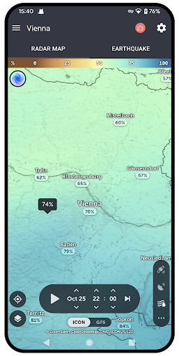
Zoom Radar & Earthquake AppIt can display radar map information data from around the world, making it easy to know weather changes, etc.Radar maps have the function of predicting for several days, playing in the form of videos, and can be viewed at the time you want, which is very practical.
🌍Earthquake MapIt is also a rare and essential feature to view earthquake data occurring in global regions, such as earthquake level, meter, depth, range, etc.
🌞 Temperature RadarIn the form of a radar map, click on the map to view temperatures and temperature range changes around the world.
🍃 Wind RadarVisualize the wind direction and speed on a map for a more intuitive and accurate display.
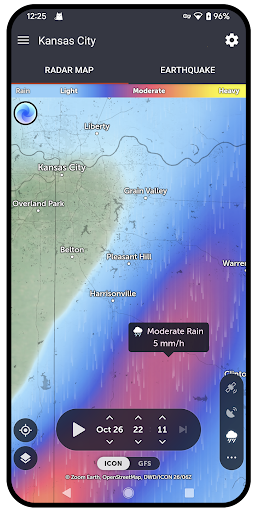
☔ Rain Radar MapYou can see which area is raining, how much rain it is, and when it will arrive.
Its really convenient and easy to use.
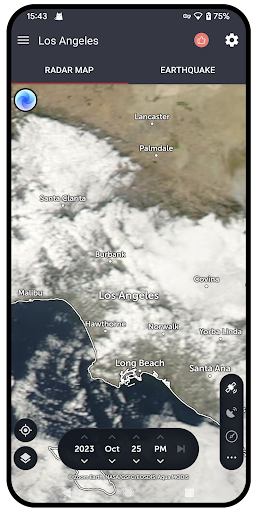
🛰️ GPS Real Time MapReal and real-time Earth meteorological changes, cloud maps, and other content can be seen, which is very powerful..
📰 More LayersRadar maps provide many layers, such as cloud maps, wind speed, rainfall, humidity, pressure, typhoons, hurricanes, animations,night boundary, etc.
Gaming Features
Enjoy immersive gaming experience with various game modes.
Camera Features
Advanced camera features with editing capabilities.
Weather Features
Get accurate weather forecasts and real-time updates.
See the Zoom Radar & Earthquakes Map in Action
Get the App Today
Available for Android 8.0 and above